
sonnig 
SCROLL
3°
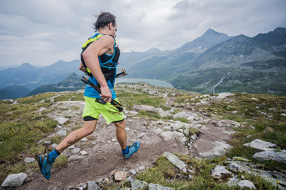
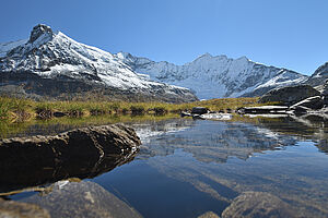
Wandern & Bergsteigen
Die Weißsee Gletscherwelt bietet vielfältige Wander- & Bergsteigmöglichkeiten aller Schwierigkeitsgrade. Dazu gibt es täglich geführte Wanderungen (siehe hier).
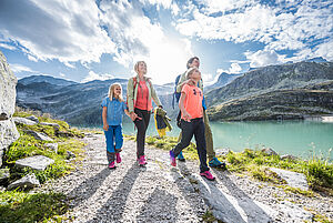
Spaziergänger finden Spazierwege in der Umgebung der Mittelstation am Grünsee, am Weißsee beim Berghotel Rudolfshütte oder auch am Aussichtsplateau Medelz auf
2.600 m Seehöhe. Hier eröffnet sich ein gewaltiges Panorama bis ins berühmte Dorfertal nach Kals am Großglockner. Wanderer erwarten mehr als 40 km markierte Wanderwege bis auf knapp 3.000 m Höhe - u.a. interessante Gletscherwege und Alpenüberquerungen. Durch ihre hochalpine Lage ist die Weißsee Gletscherwelt ein Eldorado für echte Alpinisten. Sie ist Ausgangspunkt für das Besteigen zahlreicher Dreitausender.
Unser Familienhit:
2 Kinder unter 12 Jahre fahren in Begleitung der Eltern gratis!

Easy walks
Panoramaweg Rudolfshütte (AV-Nr. 715,14)
The family-friendly “Panoramaweg” with information boards leads to the “Schafbühel” lookout point. Walking time approx. 30 min.
Alpine Flower Trail (AV-No. 715)
The starting point for this family-friendly hike is the Berghotel Rudolfshütte. From there you hike along the marked hiking trail to the Grünsee middle station. This hike is one of the easier tours. Here you will experience a unique, colorful flora. The hike leads past mountain dandelions, alpine margarites, dwarf primroses and alpine roses. Walking time approx. 2 hours
Glacier pots at Grünsee (AV-No. 715)
You walk along the hiking trail past the Grünsee. There you will discover the natural monument "Glacier Pots" at an altitude of approx. 1,710 meters. These glacier pots date from the Ice Age. They were created by meltwater that combined to form streams and formed eddies. You can see this very well in the stones. Walking time approx. 45 min.
Hike through the cradle forest
The oldest stone pines of the Hohe Tauern National Park grow in the “cradle forest of stone pines”. The path through the "primeval forest" is best taken with a ranger (see guided hikes). Walking time approx. 2.5 hours
Hike to the Kalser Törl (AV-No. 711)
The starting point is the Berghotel Rudolfshütte. From there you go down towards Weißsee. Then take the marked path in a southerly direction up to the Kalser Törl. This is the border between Salzburg and East Tyrol. Walking time approx. 1.5 hours
Moderate hikes
Glacier educational trail Sonnblickkees - "Journey to the Arctic" (AV-Nr. 715)
The starting point is the Berghotel Rudolshütte. You hike to the southwest around the Weißsee uphill to the foot of the Sonnblick-Kees. The return is the same way. The glacier trail provides a wonderful high mountain panorama with 22 peaks, 12 of which are over 3,000 meters in altitude. The path is equipped with information boards. Walking time approx. 3.5 hours
3 lakes hike (AV No. 715)
The starting point for this hike is the Berghotel Rudolfshütte. You are hiking on the Schafbühel. Once there, you can already see the Tauernmoossee with the long curved dam wall of Europe (1,100 m). You stay on the marked hiking trail until you reach the “Niedere Scharte” junction. There you turn left and hike back to the Grünsee middle station. approx. 3 hours. For particularly keen and sure-footed hikers, the AV path no. 711 via the Steinerne Stiege is also possible. Walking time approx. 3.5 hours
Ödenwinkelkees Glacier Trail (AV-No. 715)
The starting point for this hike is the Berghotel Rudolfshütte. The educational trail leads through a magnificent high mountain landscape over the Schafbühel to Eisbodenlacke. From here you hike through the railing, which has been ice-free since the middle of the last century, to the glacier face of the Ödenwinkelkees. Walking time approx. 2.5 hours
Summit hike to the Medelzkopf (AV-No. 711)
The starting point is the Berghotel Rudolfshütte. From there you go to the Medelz double chairlift and drive to the mountain station. Once there, you hike along the Medelzlacke to the viewing plateau with a wonderful view of the Dorfertal to Kals. It continues on a path to the Medelzkopf at 2,760 m. Walking time approx. 1.5 hours
Kalser-Tauern hike (AV-No. 711)
This high-alpine hike begins at the Berghotel Rudolfshütte. You go downhill to the double chairlift and drive to the mountain station. You now descend on foot to the Kalser Tauern. From there the path leads over the "earthy corner" down to the Dorfersee and up the valley to the Kalser Tauernhaus. Walking time approx. 6 hours
The hike is always offered on Saturdays (organized with a hiking guide and bus transfer)
Difficult hikes
Hochfürlegg - middle summit
From the Berghotel Rudolfshütte you hike along the glacier trail to the Sonnblickkees. At the rain gauge it goes on, past the Schafkoglsee, direction Hoch Fürleggpfeiler over smaller firn fields to the highest lake in the Hohe Tauern, the Eissee (2,913 m). From there it goes on to the central summit of the Hochfürlegg. You will experience a panoramic view from Großglockner, Großvenediger, Watzmann to the Dolomites. Walking time approx. 3 hours, highest point: 2,943 m - Hochfürlegg
Kapruner-Törl hike (AV-No. 716)
The starting point is Kaprun by bus to the Mooserboden high mountain reservoirs.
You hike along the reservoir and uphill via Wintergasse to Kapruner Törl (2,639 m). There is a wonderful panoramic view of the Kaprun and Stubach valleys and of the glaciated peaks of the Hohen Riffel and the Bärenköpfe. Between the Riffel Glacier (Hohe Riffel) and the Klein-Eiser, you stand on "Du & Du" with the glacier break. A special experience. From Kapruner Törl it goes downhill, past the lower Riffl glacier - Ochsenfleck - along the Tauernmoos lake (Europe's longest curved dam) to the Niedere Scharte and downhill to the Grünsee middle station or from Tauernmoossee via Schafbühel to the Rudolfshütte. From here, take the cable car to Enzingerboden and the hiking bus to Uttendorf. Walking time approx. 6 hours
Hans-Gruber-Weg (Weisssee circular hike)
Over the dam north past the Weißsee and from here ascent to the Sonnblick-Kees. From there to the southwest around the Weißsee. Since the section between Weißsee dam wall and Sonnblick-Kees is steep and partly leads over ladders, it is advisable to take the ascent for the circular hike over the Hans-Gruber-Weg and not over the section south around the Weißsee.
Hochalpine Bergtouren
Oberwalder Hütte - via Ödenwinkelscharte
From the Berghotel Rudolfshütte you first walk along the glacier path to the Ödenwinkel. When you arrive at the Ödenwinkelkees, you cross this partly very steeply eastwards uphill over firn fields. It continues quite steeply to the Oberen Ödenwinkelscharte and Pasterzenboden to the Oberwalderhütte. Walking time: approx. 6 hours, highest point: 3,233 m - Obere Ödenwinkelscharte
Sudeten German Hut - via Silesia Höhenweg
From the Berghotel Rudolfshütte you go to the Kalser Törl. From there you hike down to the earthy corner. Here you turn right into the demanding Silesia Höhenweg. It goes uphill to the plateau of the sea trough. A little steeply you continue to hike to Gradetzsattel, the highest point of the Glockner circuit. After about 45 minutes you will reach the Sudetendeutsche Hütte. Walking time: approx. 12 hours, highest point: 2,826 m - Gradetzsattel
Zehn Empfehlungen des österr. Alpenvereins
Tipps für sicheres Bergwandern
1. Gesund in die Berge
Bergwandern ist Ausdauersport. Die positiven Belastungsreize für Herz und Kreislauf setzen Gesundheit und eine realistische Selbsteinschätzung voraus. Vermeide Zeitdruck und wähle das Tempo so, dass niemand in der Gruppe außer Atem kommt.
2. Sorgfältige Planung
Wanderkarten, Führerliteratur, Internet und Experten informieren über Länge, Höhendifferenz, Schwierigkeit und die aktuellen Verhältnisse. Touren immer auf die Gruppe abstimmen! Achte besonders auf den Wetterbericht, da Regen, Wind und Kälte das Unfallrisiko erhöhen.
3. Vollständige Ausrüstung
Passe deine Ausrüstung deiner Unternehmung an und achte auf ein geringes Rucksackgewicht. Regen-, Kälte- und Sonnenschutz gehören immer in den Rucksack, ebenso Erste-Hilfe-Paket und Mobiltelefon (Euro-Notruf 112). Karte oder GPS unterstützen die Orientierung.
4. Passendes Schuhwerk
Gute Wanderschuhe schützen und entlasten den Fuß und verbessern die Trittsicherheit! Achte bei deiner Wahl auf perfekte Passform, rutschfeste Profilsohle, Wasserdichtigkeit und geringes Gewicht.
5. Trittsicherheit ist der Schlüssel
Stürze, als Folge von Ausrutschen oder Stolpern, sind die häufigste Unfallursache! Beachte, dass zu hohes Tempo oder Müdigkeit deine Trittsicherheit und Konzentration stark beeinträchtigen. Achtung Steinschlag: Durch achtsames Gehen vermeidest du das Lostreten von Steinen.
6. Auf markierten Wegen bleiben
Im weglosen Gelände steigt das Risiko für Orientierungsverlust, Absturz und Steinschlag.
Vermeide Abkürzungen und kehre zum letzten bekannten Punkt zurück, wenn du einmal vom Weg abgekommen bist. Häufig unterschätzt und sehr gefährlich: Steile Altschneefelder!
7. Regelmäßige Pausen
Rechtzeitige Rast dient der Erholung, dem Genuss der Landschaft und der Geselligkeit. Essen und Trinken sind notwendig, um Leistungsfähigkeit und Konzentration zu erhalten. Isotonische Getränke sind ideale Durstlöscher. Müsliriegel, Trockenobst und Kekse stillen den Hunger unterwegs.
8. Verantwortung für Kinder
Beachte, dass Abwechslung und spielerisches Entdecken für Kinder im Vordergrund stehen! In Passagen mit Absturzrisiko kann ein Erwachsener nur ein Kind betreuen. Sehr ausgesetzte Touren, die lang anhaltende Konzentration erfordern, sind für Kinder nicht geeignet.
9. Kleine Gruppen
Kleine Gruppen gewährleisten Flexibilität und ermöglichen gegenseitige Hilfe. Vertraute Personen über Ziel, Route und Rückkehr informieren. In der Gruppe zusammen bleiben. Achtung Alleingänger: Bereits kleine Zwischenfälle können zu ernsten Notlagen führen.
10. Respekt für Natur und Umwelt
Zum Schutz der Bergnatur: Keine Abfälle zurücklassen, Lärm vermeiden, auf den Wegen bleiben, Wild- und Weidetiere nicht beunruhigen, Pflanzen unberührt lassen und Schutzgebiete respektieren. Zur Anreise öffentliche Verkehrsmittel verwenden oder Fahrgemeinschaften bilden.
![[Translate to Česky:]](/fileadmin/_processed_/5/6/csm_Familie_Jausnen_Sommer_d142f8641d.jpg)